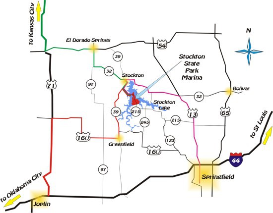
LOCATION MAP
Park Address: 19100 215 Highway, Dadeville Missouri
From the Damsite
To Nevada . . . . . . 44 miles
To Springfield . . . . . . 51 miles
To Joplin . . . . . . .83 miles
To Kansas City . . . . . .136 miles
To Jefferson City . . . . . . . 140 miles
To St. Louis . . . . . . . 269 miles
To Wichita . . . . . . . 200 miles
Directions to Stockton State Park
From Kansas City:
Take Highway 71 south to Sheldon. Take B Highway east to 39 North. Go 2.5 miles to Highway 215. Take a right. Go 6 miles. Once you cross the bridge you are in Stockton State Park.
From Springfield, Missouri:
Take Highway 13 north to Highway 32 at Bolivar. Take Highway 32 west through Fair Play. Turn left on Highway 245. Follow 245 and then turn right on Highway 215 at Bona. Follow Highway 215 (will turn right). Go 4 miles and you will enter Stockton State Park.
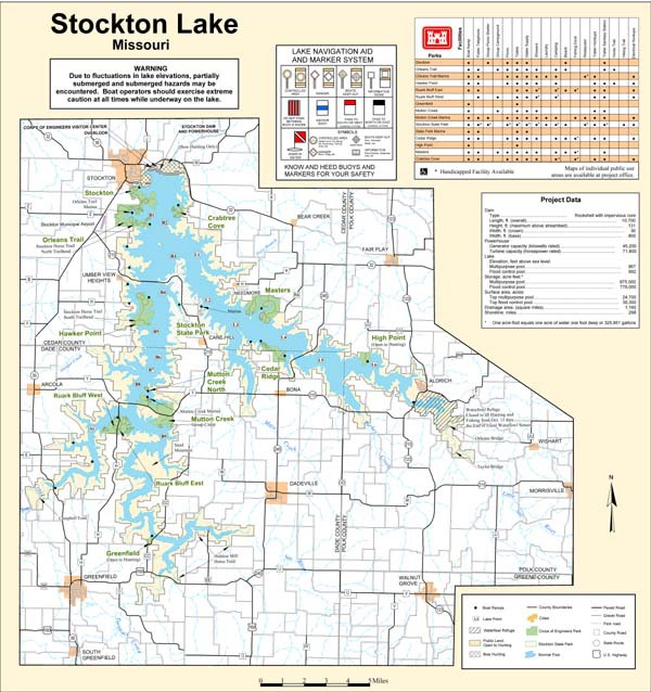
Lake Map
Stockton State Park - Point L2 (Little Sac Arm)
Park Address: 19100 215 Highway, Dadeville Missouri
From the Damsite
To Nevada . . . . . . 44 miles
To Springfield . . . . . . 51 miles
To Joplin . . . . . . .83 miles
To Kansas City . . . . . .136 miles
To Jefferson City . . . . . . . 140 miles
To St. Louis . . . . . . . 269 miles
To Wichita . . . . . . . 200 miles
Directions to Stockton State Park
From Kansas City:
Take Highway 71 south to Sheldon. Take B Highway east to 39 North. Go 2.5 miles to Highway 215. Take a right. Go 6 miles. Once you cross the bridge you are in Stockton State Park.
From Springfield, Missouri:
Take Highway 13 north to Highway 32 at Bolivar. Take Highway 32 west through Fair Play. Turn left on Highway 245. Follow 245 and then turn right on Highway 215 at Bona. Follow Highway 215 (will turn right). Go 4 miles and you will enter Stockton State Park.
Lake Map
Stockton State Park - Point L2 (Little Sac Arm)
Contact Us Today!
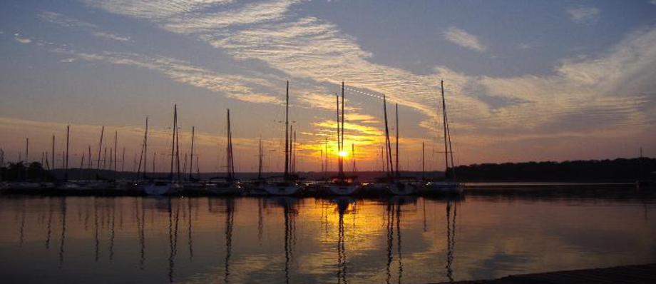
Stockton State Park Marina
Phone: 417-276-5329
Find us on Facebook, Twitter, and Instagram
PO Box 429
Stockton, Missouri 65785